LUKA GNSS Receiver

Ultra-compact lMU-GNSS receiver easy to carry and operate

Main Features

IMU-GNSS
Fusion

Calibration-free and is immune to magnetic interference.

Centimeter Precision

Tested accuracy of 2cm when tilted at 60° (2m or 1.8m pole).

Vibration Resistance INS Performance

Efficiency goes up by 30% when continuously surveying with Tersus Rod-Tip-Roller.

Survey without Tilt Angle Limitation

Tested RMS error of 3.7cm at a tilt angle of 110°.

Fix in seconds

Powered by 1568 channels, LUKA can track full-constellation and multi-frequency for enhanced performance. LUKA provides centimetre-level positioning accuracy, and fix in seconds even in challenging conditions.

Compact and exquisite design

LUKA is a pocket-sized and lightweight receiver, measuring 132x68mm and weighing just 827 grams. It includes an internal battery, radio modem, and 4G network modem for seamless work on the go.

Powerful and smart battery

Built-in high-capacity lithium battery provides 19 hours of field work, with a smart power display. It can be quickly charged in about 3 hours, and a power bank can be used during field surveying work.

Engineered for field work

LUKA is IP68 rated with an industrial-grade design, making it durable and reliable even under the harshest conditions. It’s also drop-proof, with the ability to withstand a 2-meter pole drop onto concrete.

TC80 and NUWA

The TC80 controller is a rugged multi-function data controller with a 5.5″ sunlight-readable HD touchscreen design and alphanumeric keypad. It is equipped with a powerful octa-core processor and Android operating system, perfect for adapting to NUWA app, which is our versatile and FREE survey field software with easy-to-use graphical interfaces and powerful features.

Tersus Geo Office 2(TGO2) Post Processing Software


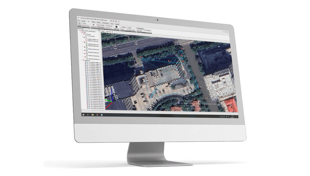
Tersus Geo Office 2 is a desktop data processing software based on Windows OS, designed by Tersus GNSS Inc, and all rights reserved. TGO2 has various functions, covering multiple business modules for professional users, supporting GNSS post-processing and network adjustment, road design and inspection, RTK project processing, and point cloud data processing.